

FREE DELIVERY ON ORDERS OVER £25
ALWAYS UP TO 70% OFF RRP
SIGN UP FOR OFFERS AND EXCLUSIVES
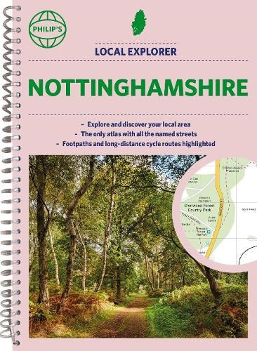
Philip's Local Explorer Street Atlas Nottinghamshire: Spiral Edition (Spiral-bound)
Philip's Maps (Author)
- £3.00
-
£16.99 - £3.00
- Unit price
- per
Save £13.99
Please hurry! Only 2 left in stock
10 customers are viewing this product
Couldn't load pickup availability
Free Shipping
Free standard shipping on orders over £25
Same day dispatch.
Free Returns
Learn More.

- Publisher: Philip's
- ISBN: 9781849076425
- Pages: 272
- Weight: 0.6
Philip's has been at the forefront of creating maps and atlases since 1834. Whether a local street map or a fact-packed World Atlas, we use the most up-to-date technology, expertise and our global network to ensure our customers have all the information they need.
Related Products
Example product title
- £3.00
-
£16.99 - £3.00
- Unit price
- per
Save £13.99
Example product title
- £3.00
-
£16.99 - £3.00
- Unit price
- per
Save £13.99
Example product title
- £3.00
-
£16.99 - £3.00
- Unit price
- per
Save £13.99
Example product title
- £3.00
-
£16.99 - £3.00
- Unit price
- per
Save £13.99
Example product title
- £3.00
-
£16.99 - £3.00
- Unit price
- per
Save £13.99
Example product title
- £3.00
-
£16.99 - £3.00
- Unit price
- per
Save £13.99
Example product title
- £3.00
-
£16.99 - £3.00
- Unit price
- per
Save £13.99
Example product title
- £3.00
-
£16.99 - £3.00
- Unit price
- per
Save £13.99
Example product title
- £3.00
-
£16.99 - £3.00
- Unit price
- per
Save £13.99
Example product title
- £3.00
-
£16.99 - £3.00
- Unit price
- per
Save £13.99
Recently Viewed Products
Example product title
- £3.00
-
£16.99 - £3.00
- Unit price
- per
Save £13.99
Example product title
- £3.00
-
£16.99 - £3.00
- Unit price
- per
Save £13.99
Example product title
- £3.00
-
£16.99 - £3.00
- Unit price
- per
Save £13.99
Example product title
- £3.00
-
£16.99 - £3.00
- Unit price
- per
Save £13.99
Example product title
- £3.00
-
£16.99 - £3.00
- Unit price
- per
Save £13.99
Example product title
- £3.00
-
£16.99 - £3.00
- Unit price
- per
Save £13.99
Example product title
- £3.00
-
£16.99 - £3.00
- Unit price
- per
Save £13.99
Example product title
- £3.00
-
£16.99 - £3.00
- Unit price
- per
Save £13.99
Example product title
- £3.00
-
£16.99 - £3.00
- Unit price
- per
Save £13.99
Example product title
- £3.00
-
£16.99 - £3.00
- Unit price
- per
Save £13.99
- Choosing a selection results in a full page refresh.